
Situated in the North Atlantic between Scotland and Iceland, the Faroe Islands isn’t at the top of many people’s dream destination lists. And that’s fine, because for hikers, the sparsely populated rocks are paradise
The Faroe Islands off Iceland consist of 18 rocky and volcanic islands, most of them connected by bridges, tunnels and ferries. From a distance they look dreamy, covered in lush green grass and featuring spectacularly steep cliffs. Up close, they offer incredible hiking routes. Those steep cliffs — many hundreds of metres high — the hiking is not for the faint hearted. But if you’re up for the challenge, you can access some amazing views without too much effort.
I visited the Faroes for a week to explore as much as possible of the territory and its nature. What stood out for me is how accessible the hikes are and the places you get to. The word “breathtaking” truly gets a new meaning in the Faroes.
Here’s a list of my favourite hikes when visiting the Faroe Islands:
View on the breathtaking Drangarir hike. Photo: Ása Steinars
Trælanípan
This is one of the two best known and most popular hikes in the Faroes. It has a well-marked trail and at the start you’ll find a cozy café serving coffee and sandwiches. After about an hour walk next to a lake, a steep hill will lead you up the final stretch to the viewpoint. Trælanípan is like a water-side Lion King cliff, steep on all sides and shooting out into the ocean with a vertical drop on three sides. From the lake flows Bøsdalafossur waterfall, dropping a spectacular 60 metres straight down to the Atlantic Ocean.
Related: How to explore Iceland’s Westman Islands in one day
Trælanípan is one of the most popular places to hike in the Faroes. Photo: Ása Steinars
Dunnesdrangar
Dunnesdrangar is one of those places that look incredible in pictures but when you’re there you realise they’ve not even come close to capturing the reality. It’s not a very famous hike so there’s not a real path to walk on, but once you get there the views are literally breathtaking. You’ll find yourself standing on top of a 200-metre vertical cliff, looking down at the large sea stacks with thousands of birds circling between them.
To find the trail, park in Sørvágur and fire up Google Maps. There’s no official trail here, but a small stream will lead you almost all the way. Once you’ve found it, just follow along until you get to the ocean.
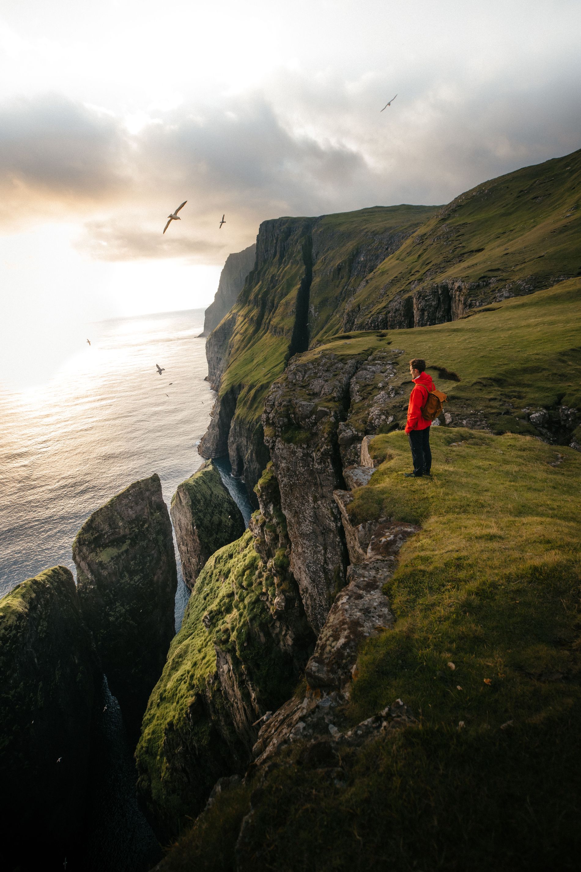
The Dunnesdrangar will allow you to view the ocean from 200 metres above. Photo: Ása Steinars
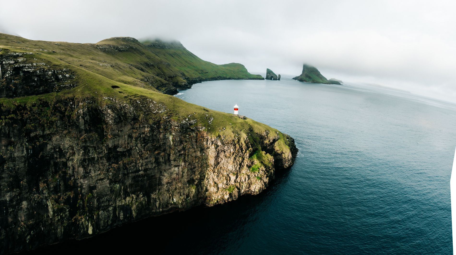
Kallur Lighthouse
A small ferry taking only 13 cars at a time transports you out to the island of Kalsøy. It’s a narrow island with one single road leading up to the northern tip. From a tiny town located in a beautiful valley, the trail up to Kallur Lighthouse begins. Expect the friendly Faroese sheep to accompany you along the path and about an hour later you’ll find what’s probably one of the most scenic lighthouses anywhere in the world.
Related: A scenic stay: the 5 best nature hotels in the Nordics
Kallur Lighthouse is one of the most stunning lighthouses in the world. Photo: Ása Steinars
Klakkur
Klakkur viewpoint overlooks the second largest town of Faroe, Klaksvik. A bumpy gravel road takes you halfway up the mountain and from here you hike out on a ridge all the way to the end of an elongated mountain. Klakkur is a great sunset spot and it’s beautiful to see how the lights of Klaksvik turn on and transform the city into night mode. Look in the other direction and you face the steep tip of Kunøy and the dragon-shaped ridges of Kalsöy.
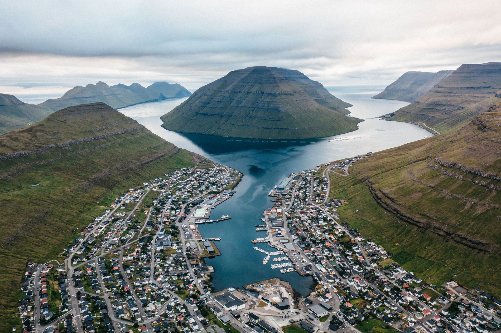
Do the hike at sunset and watch the glow of the city. Photo: Ása Steinars
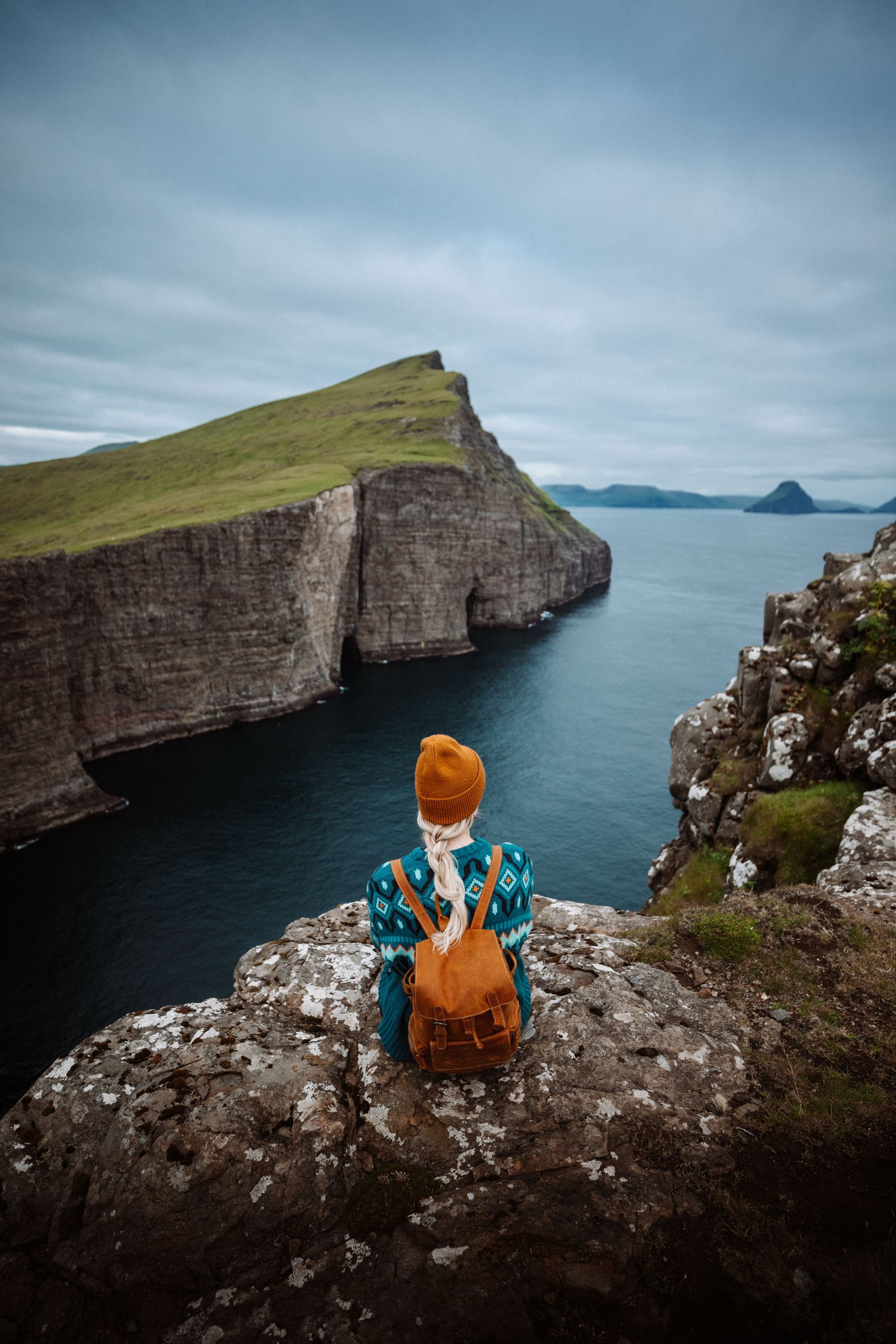
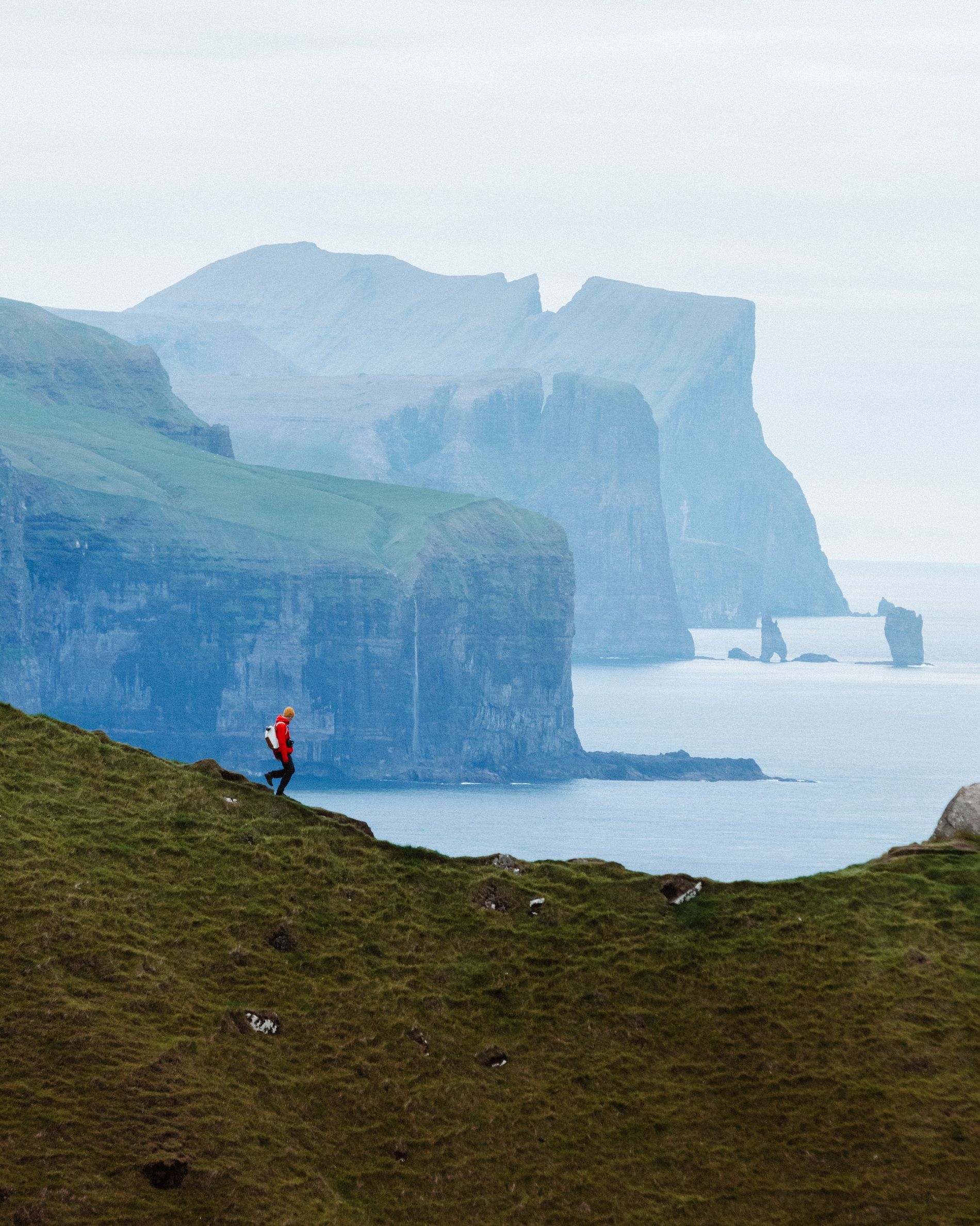
Drangarir
The Holy Grail of hikes in the Faroes is the hike to Drangarnir. It’s a long hike that takes up to eight hours there and back but it is 100 per cent worth it. Due to its difficulty and the fact that you have to pass through private land, it can only be done with a guide, so make sure to book in advance.
After 10km and crossing two valleys, you’ll get to the end point and the view over Drangarnir. Behind, lies the island of Tindholmur, shaped like a dragon. On good weather days you can get a pick up by boat. Before it takes you back to port, it will drive around Drangarnir and if you’re lucky through the hole in the rock.
Related: Chasing Waterfalls: Kvernufoss in Iceland is a hidden treasure
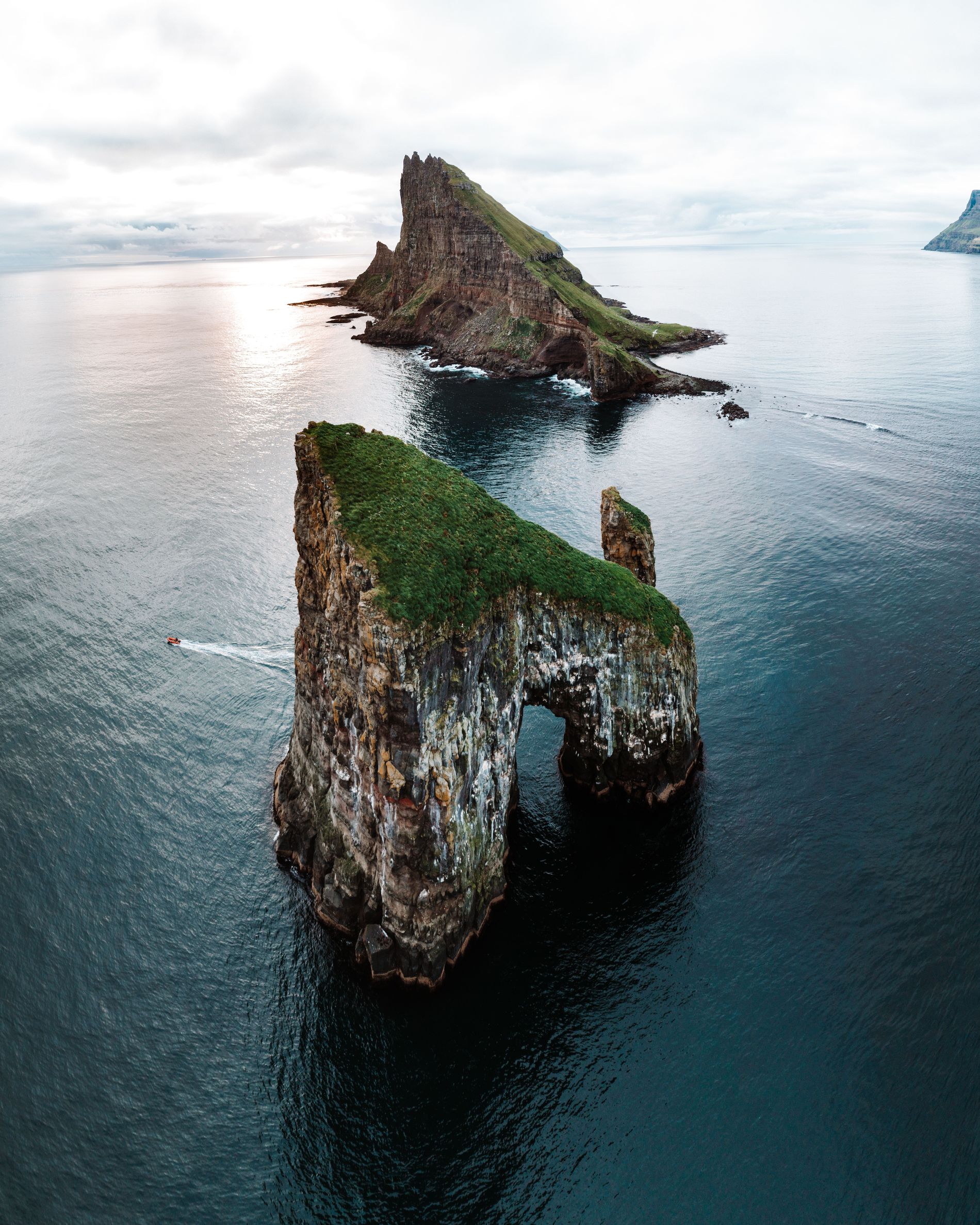
Drangarnir is the longest most difficult hike you can do on the island but well worth it. Photo: Ása Steinars